Point Pinole Eucalyptus Survey
Flight Areas
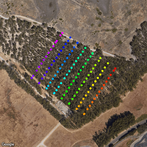
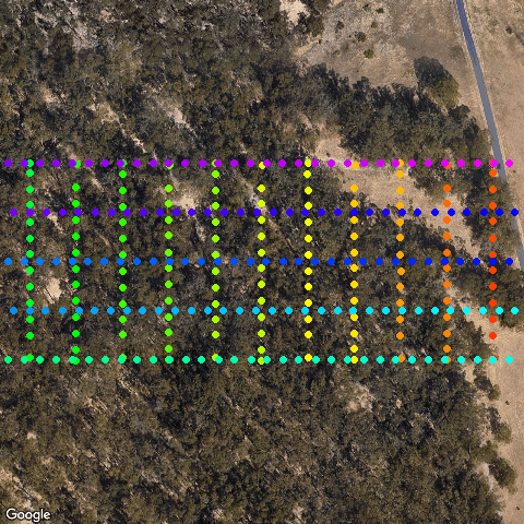
Point Pinole, Eucalyptus Grove East, Flight 1 of 3 (Pass 1, SW)
Flight over east grove of Eucalyptus trees. First pass of a double-grid mission.
Date captured: 2020-08-06
Pilot: Andy Lyons
Camera: DJI Phantom 4 Pro
Num images: 118
Area: 39.9 acres
Data size: 943 MB
Contact: Andy Lyons
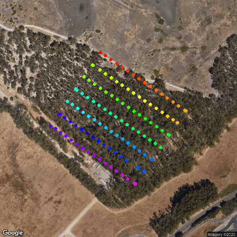
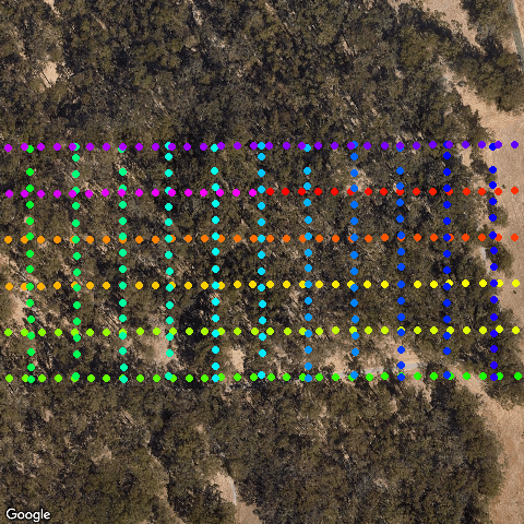
Point Pinole, Eucalyptus Grove East, Flight 1 of 3 (Pass 2, SE)
Flight over east grove of Eucalyptus trees. Second pass of a double-grid mission.
Date captured: 2020-08-06
Pilot: Andy Lyons
Camera: DJI Phantom 4 Pro
Num images: 118
Area: 40.6 acres
Data size: 945 MB
Contact: Andy Lyons
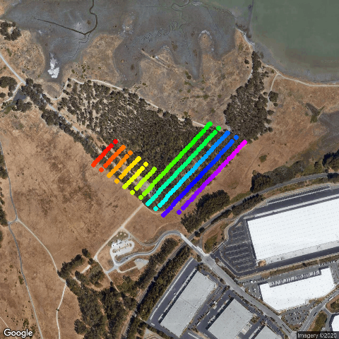
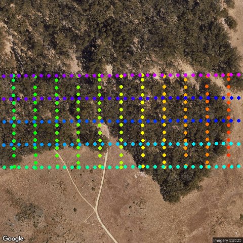
Point Pinole Eucalyptus Grove East, Flight 2 of 3
Flight over east grove of Eucalyptus trees
Date captured: 2020-08-06
Pilot: Andy Lyons
Camera: DJI Mavic 2 Pro
Num images: 190
Area: 51.2 acres
Data size: 2,379 MB
Contact: Andy Lyons
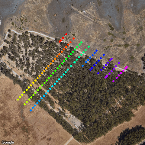
Point Pinole Eucalyptus Grove East, Flight 3 of 3
Flight over east grove of Eucalyptus trees
Date captured: 2020-08-06
Pilot: Andy Lyons
Camera: DJI Mavic 2 Pro
Num images: 121
Area: 41.9 acres
Data size: 1,461 MB
Contact: Andy Lyons
Point Pinole, West Grove, Flight 01
Flight over west grove of Eucalyptus trees, 390 ft, 90% overlap, 75 degrees off-nadir
Date captured: 2020-08-14
Pilot: Andy Lyons
Camera: DJI Mavic 2 Pro
Num images: 345
Area: 32.2 acres
Data size: 4,237 MB
Contact: Andy Lyons
Point Pinole, West Grove, Flight 02
Flight over west grove of Eucalyptus trees, 390ft, 90% overlap, 75 degrees off-nadir
Date captured: 2020-08-14
Pilot: Andy Lyons
Camera: DJI Mavic 2 Pro
Num images: 405
Area: 34.5 acres
Data size: 4,921 MB
Contact: Andy Lyons
Point Pinole, West Grove, Flight 03
Flight over west grove of Eucalyptus trees, 390ft, 90% overlap, 75 degrees off-nadir
Date captured: 2020-08-14
Pilot: Andy Lyons
Camera: DJI Mavic 2 Pro
Num images: 344
Area: 30.9 acres
Data size: 4,140 MB
Contact: Andy Lyons